
P+H: Platforming and Digital Innovation – report
2NQ Team, 30 September 2020
In 2019-20, 2NQ ran a programme of heritage events and activities called People + Heritage with the communities around Finsbury Park, supported by funding from the National Lottery Heritage Fund and Haringey Council. The programme included two digital innovation projects.
Platforming the park
Our objective with the overall design of the project was to show how ‘platforming’ the park was integral to giving people a window into its past, along with its future direction, as a key green space asset. With the technical aspect of this, we wanted to integrate the use of digital, as a way of providing many routes into Finsbury Park. At this point, we had not of course considered the impact of the pandemic on our use digital media.
Expanding and explaining the idea of ‘platforming’ a green space, we had some strong ideas at the project design stage. However, the process of delivering them revealed outcomes that could only be understood though working with people across a wide age group. For example, the uptake of digital activities does not follow one particular age or demographic group, it needs to be multiple in form.
In terms of platforming, a park is more than just a leisure space, it has temporal and spatial dimensions in how people think about it culturally, politically and socially. It has layers of history, human experience and all this can be activated in the digital realm.
Platforming then takes on a number of aspects:
- The park as a site for learning and adventure
- The park as a place for leisure and well-being
- The park as a place for community events and celebration
- The park as a site of historical importance
- The park as a place for digital enhancement (e.g. augmented reality)
- The park as a site for research and expanded thinking about location (e.g. LiDAR scans and resources)
- The park as a virtualised experience for people who have mental health or mobility issues
- The park as an exhibition space
In this context of platforming a park, the People + Heritage programme generated practical outputs that are evidenced in the photo documentation and feedback from users. We now know that digital mediation of heritage assets needs to follow more than just one route, such as targeting mobile devices, or young people, or new users.
The user groups for platforming include:
- The alternative education group that meets in the park, who experienced the exhibition as family groups
- The school groups who used the park for creative play and adventure
- The Safe Space attendees who experienced the virtualised form of Finsbury Park during lockdown
- The vicarious passers-by who encountered the exhibition
- The online visitors who viewed the exhibition, maps and LiDAR scans
- The integration and articulation of these as a whole, through social media, local group meeting and a talks programme.
Our approach to digital has been public facing. We now have an important resource of key data to inform our programme and engage the community more broadly in further heritage-related activities.
What happened?
1. Augmented Reality
The augmented reality trail has been delivered as a public-facing project that can be explored in the park as part of the People’s Park Exhibition (see p. 66), with access as a predominant feature. Augmented reality as a medium sets out to provide augmented experiences through the field of vision on a mobile device or headset, unlike virtual reality that is confined to headsets or mobile phone add-ons (such as Google Cardboard), which provide access to 360o worlds.
We deployed AR.js for our project in Finsbury Park, following our general through-line of using Open Source technologies. AR.js build on the work of an open source development that enables browser-based experiences on iOS and Android smartphones. In this case native ‘app’ development is not necessary, as the code runs in the web browser using GPS.
To the best of our knowledge, this is the first time that non-app-based augmented reality has been used in a UK heritage project.
The augmented reality assets were drawn from the general research for the broader exhibition project, working over the project delivery period, including an early image of Queen Victoria, Jim the Elephant and more recently Johnny Rotten. We tested this with people in the park, who were surprised at what could be done with mobile AR.
The interaction design comprised a simple ‘call to action’ via a QR code on the exhibition panels which then initiates the camera on the client device (smartphone). At this point the AR content loads into memory on the device and the trail can be explored. This contrasts with an app-based development route, which requires a full download prior to a successful interaction.
Mobile web app-based AR offers a number of advantages over native app-based experiences:
- One development path in terms of code base for iOS and Android
- Extensibility and rapid testing in terms of coding time
- Use of GPS in web to a high level of accuracy
- Ease of use to clients
- No App Store submission process
- Can be edited and redeployed
Project outcomes
The AR trail expanded the appeal of the People’s Park Exhibition to different groups and a wider demographic interested in digital innovation, and enhanced the experience of the exhibition for visitors. The art created for use in the trail can also be viewed as a continuing legacy in the online exhibition on the 2NQ website, where the AR project is also explained.
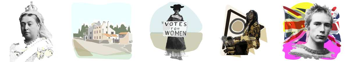
Some of the imagery created for use in the AR trail: Queen Victoria, Hornsey Wood Tavern, Emmeline Pankhurst, Alex Dayo and Johnny Rotten
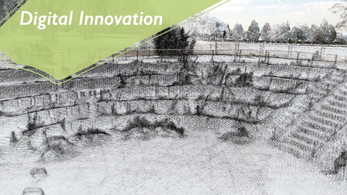
2. LiDAR
Within our proposal for People + Heritage we planned to scan elements of Finsbury Park, which we hoped could include the underground reservoir.
As regards the reservoir element, we obtained permission and cooperation from both Haringey Council and Thames Water to undertake the work. The Coronavirus emergency, however, made this impossible, first because all non-essential activity was banned by the Government the day before the first scan was due to take place, and second because the cancellation of the park’s commercial live events programme had the additional consequence that the annual pumping out of excess water has been indefinitely postponed. The team hope to revisit this opportunity in future when circumstances permit.
In light of the Coronavirus situation, we expanded the range of the work done above ground and succeeded in creating a 3D record of the entire park, comprising a full set of LiDAR scans that have been stitched together to form a model. This is a large amount of data of all of the key historic areas of the park.
Project outcomes
This data is hosted on our servers and available through the 2NQ website, offering an open public facility to view the park from multiple points, including Seven Sisters Road, the historic Finsbury Gate and the boating lake.
The LiDAR data provides an accurate record in terms of the layout of the park but also gives us an offline tool to work with partners such as Haringey Council on rethinking future access issues concerning the park. For example, we will be able to model the removal of the fencing, in part or whole, on the Seven Sisters Road side.
In addition, the scan of the park provides hyper-accurate information on the position and condition of trees and other natural elements of the park. We are investigating ways to share this data with other users. The central approach of the whole project has been ‘open source’ and we are investigating ways that the data itself can be preserved as an archival asset.
We have created a number of 360o VR pieces from the LiDAR that can be viewed on mobile devices.
A three-dimensional LiDAR (Light Detection and Ranging) scan of the whole of Finsbury Park using 27 points of interest and eight loops was completed on 11 August 2020.
A map detailing the POIs and loops used can be viewed on the 2NQ website at https://2nq.uk/maps/lidar-and-exhibition-map.
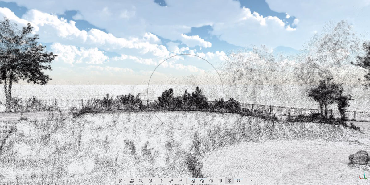
LiDAR scan view of an area in Finsbury Park
The purpose of completing such a scan was threefold:
- To capture this important heritage asset for the community in digital form.
- To create a tool to facilitate open consultation and consider the impact of diverse policy options for maintenance and development of the park.
- To create a resource for digital creative innovation.
The purpose of creating a range of new heritage assets for the community was achieved. We aim to develop this with future projects addressing both access to heritage and digital creative innovation.